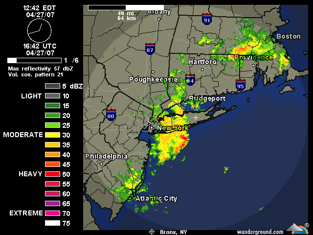
First, you can see the current lull in the precip:
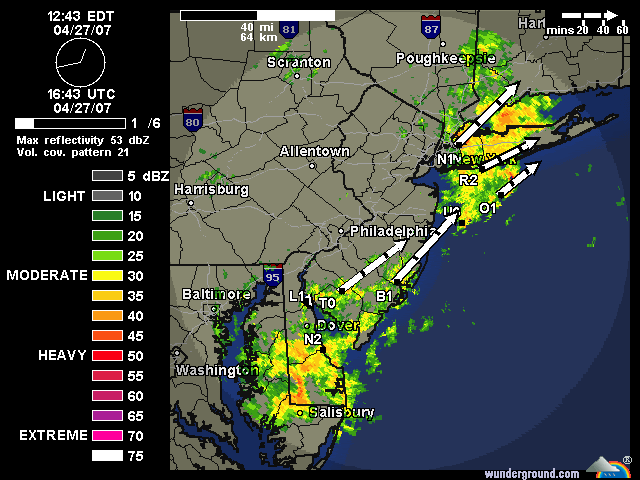
Next, you can see what is coming from our south. It looks like most of these showers and T-Storms will miss the Bronx to the South and East
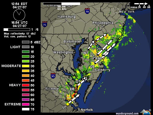
And just to be safe we will look even FURTHER south to see what will be heading towards the area at around game time. This concerns me a little more, but the storm tracks still indicate that the heaviest precip will miss the Bronx to the South and East again. Lets hold our fingers with this batch of precip: